Drakensberg mountains, April 1961 |
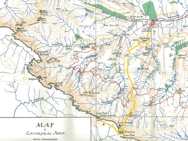 On this “Cathedral area” map, using a yellow-orange line I’ve marked the route we took. From our campsite near the Cathedral Peak hotel, we headed up past the Camel (which we couldn’t see for mist), through Windy Gap, past the Organ Pipes, and onto the Basutoland (now Lesotho) plateau, where we camped at the foot of Cleft Peak. A small red triangle gives a rough indication of where we camped. The following morning we climbed to the top of Cleft Peak, and the next day we returned to our base camp. |